

Enhanced Investment Planning through GIS Integration
When deciding which investments to make, asset managers are faced with multiple competing factors. From asset needs to strategic targets and constraints, planners must find a way to balance service levels, funding, corporate goals, supply chain requirements, work bundling and more to achieve the greatest value from their investments. Without an asset investment planning solution, evaluating all of these elements is a huge task, and one that requires a significant amount of time and effort.
What if asset managers had access to all these factors in one solution, and were able to leverage geospatial location and geometry data to further enhance planning activities?
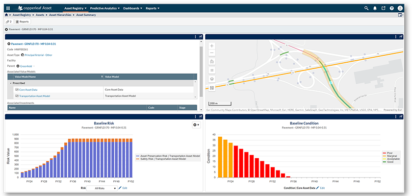
Geospatial Enablement within the Copperleaf® product suite offers an asset map for geospatial context, an investment map to locate investments and edit asset associations, and an asset strategy comparison to evaluate asset strategies and visualise their outcomes.
In a recent webinar, we showed how leveraging geospatial asset data within the Copperleaf asset investment planning solution enables asset managers to:
- Create higher value investment plans—visualise asset condition, risk, interventions, and other characteristics geospatially for more informed decision making
- Improve planning efficiency—gain immediate access to information across your asset base, including geospatial data and other relevant GIS (geographic information system) layers, like population and traffic density or other socio-economic components
- Proactively manage asset risk based on location—understand asset risk by area and bundle work to minimise disruption and increase efficiency
Copperleaf’s Geospatial Enablement features allow users to leverage GIS data to improve investment planning
During the webinar, we demonstrated three key GIS integration capabilities:
1. Geospatial Visualisation of Your Asset Base
Asset managers can gain visual context into asset relationships from one point of entry, with individual assets and/or asset groups visualised on a map. Powerful filtering and layering capabilities empower you to leverage any geospatial data in your system, allowing you to make well-informed decisions by combining geospatial visualisation with risk analysis within the Copperleaf solution.
For example, planners can visualise a road and combine traffic information with asset information in a single map view. This may then trigger a new investment proposal to ensure the highest-value plan can be identified, funded, and executed.
2. Associating Assets to Investments Based on Maps and Layers
By visually analysing neighbouring investments and leveraging investment geometries, asset managers can gain new insights into investment groupings, timing, and geospatial location. This improves the accuracy and completeness of investments and facilitates more agile decision-making. Within the planned scope of the investment, asset managers can select associated assets from a map and ensure all relevant assets are included. The true value of investments can be misinterpreted when the scope is incomplete, potentially leading to increased resource requirements, mobilisation, and/or planning costs as a result of multiple interventions.
3. Guided Investment Creation
Copperleaf’s GIS capabilities allow organisations to quickly and easily create investment proposals based on maps and GIS data. By dragging circles or squares on the map to incorporate assets, asset managers can seamlessly generate new investments and accelerate the cycle between emerging asset needs and investment planning. This feature enables rapid decision-making, enhances agility, and ensures accurate investment configurations.
Taking advantage of GIS functions is critical for continuous, informed decision making. The webinar offered a glimpse into the immense potential of these features, and how Copperleaf clients are leveraging geospatial visualisation for investment optimisation. Providing rapid time to value with low risk, non-disruptive and low configuration integration, Copperleaf continues to deliver value through Geospatial Enablement by including new functionality and improved visualisations on our multi-release roadmap.
Get in touch with the Copperleaf team to learn more and find out how you can leverage geospatial visualisation in your organisation.